
There is an old maritime saying that captures the essence of sailing in the far south: ‘below 40 degrees latitude, there is no law; below 50 degrees, there is no God.’ At 55°58′S and 67°16′W, Cape Horn sits firmly in that lawless territory, marking the point where the Atlantic and Pacific oceans collide in one of the most dramatic geographic locations on Earth.
For centuries, this rocky headland represented both the ultimate challenge and the gateway to global trade. Today, it remains a place of profound natural beauty and historical significance. This article explores where Cape Horn is located on the map, why it earned its fearsome reputation, and how modern travelers can safely experience this legendary destination.

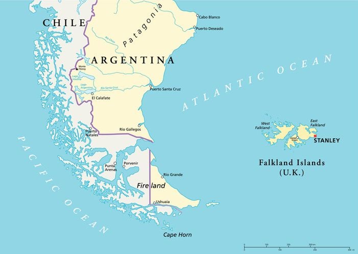
Where is Cape Horn on the map?
Cape Horn is located on Hornos Island, a small landmass in the Hermite Islands group at the southern tip of the Tierra del Fuego archipelago. It belongs to Chile and forms part of the Cabo de Hornos National Park.
Understanding Cape Horn’s position helps explain its importance:
- Geographic coordinates: 55°58′S, 67°16′W, placing it among the southernmost points of South America
- Northern boundary of the Drake Passage, the 650-kilometer strait separating South America from Antarctica
- Meeting point of the Atlantic and Pacific oceans, creating unpredictable maritime conditions
- Part of the Magallanes y la Antartica Chilena administrative region, Chile’s southernmost territory
It is worth noting that Cape Horn is not technically the southernmost point of South America. That distinction belongs to Águila Islet in the Diego Ramírez Islands, about 100 kilometers further south. However, Cape Horn remains the symbolic ‘End of the World‘ due to its historical significance and accessibility.
What is the history of Cape Horn?
Cape Horn was first rounded on January 29, 1616, by Dutch navigators Willem Schouten and Jacob Le Maire aboard the Eendracht. They named it after Hoorn, their hometown in the Netherlands.
Before this discovery, ships traveling between Europe and Asia had only two options: the Strait of Magellan or the long route around Africa’s Cape of Good Hope. Both were controlled by the Dutch East India Company. The new passage around Cape Horn offered an alternative that, while dangerous, was often faster for sailing vessels.
From 1616 until the opening of the Panama Canal in 1914, Cape Horn was one of the world’s most important shipping routes. Clipper ships carried gold, grain, and passengers around the horn, connecting the east and west coasts of the Americas and linking Europe with the Pacific trading ports.
The human cost was significant. Historical records suggest that over 800 ships were lost in the waters around Cape Horn, with thousands of sailors perishing in the cold, turbulent seas. ‘Rounding the horn’ became a legendary feat, and sailors who survived the passage often wore a gold earring as a badge of honor.
Is Cape Horn as dangerous as they say?
The waters around Cape Horn have long been considered among the most treacherous on Earth due to a combination of geographic and meteorological factors that create extreme sailing conditions year-round.
Several factors contribute to the dangerous reputation of these waters:
- Powerful winds: the region lies in the path of the ‘Roaring Forties’ and ‘Furious Fifties,’ where westerly winds circle the globe unimpeded by any landmass
- Massive waves: the shallow seabed causes swells to build dramatically, with waves occasionally reaching 30 meters
- Strong currents: the convergence of two oceans creates unpredictable and powerful water movements
- Icebergs: drifting ice from Antarctica poses an additional hazard, particularly in certain seasons
- Limited visibility: fog, rain, and snow are common, making navigation challenging
Average wind speeds hover around 30 kilometers per hour, with squalls frequently exceeding 100 km/h. The annual average temperature is just 5°C, and rainfall occurs on approximately 280 days each year.
These conditions could be extremely dangerous for ships of yesteryear. Today, however, current technologies and designs have made it possible for this route, which was once navigated with fear and out of necessity, to be explored safely and purely for pleasure today.
What can you see at Cape Horn today?
Despite its remote location, Cape Horn offers several points of interest for visitors who manage to reach its shores. The Chilean Navy maintains a permanent station on the island, and the site has been developed to honor its maritime heritage.
Visitors can explore the following attractions:
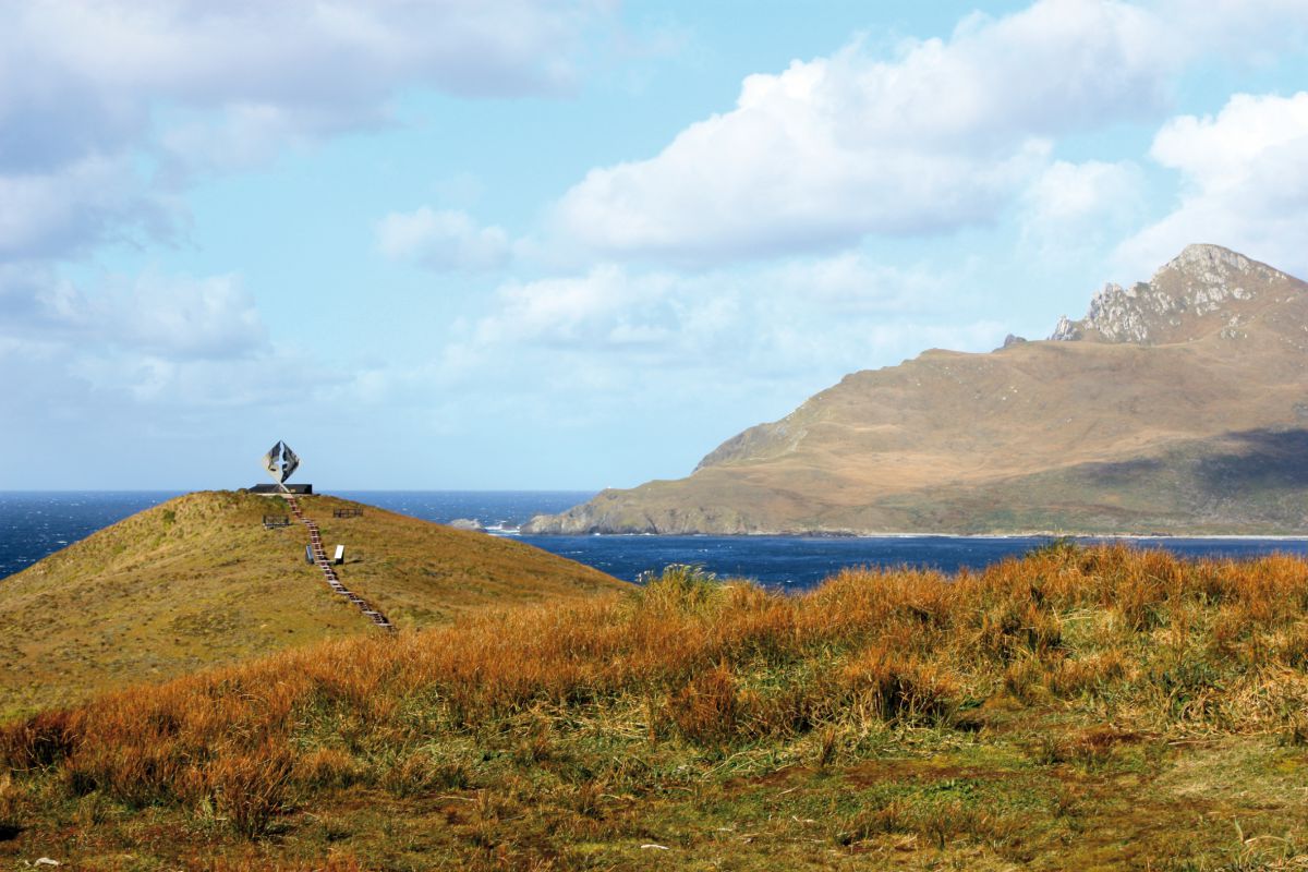
- The Albatross Monument: a striking steel sculpture erected in 1992, depicting an albatross in flight as a memorial to sailors lost at sea
- Sara Vial’s poem: a marble plaque near the monument featuring a moving verse by the Chilean poet honoring fallen mariners
- The lighthouse: a functional beacon that continues to guide vessels through these waters
- The naval station: home to a small chapel and residence where navy personnel live year-round
- The viewpoint: offering panoramic views of the Drake Passage and surrounding islands
How can you visit Cape Horn?
The safest and most comfortable way to visit Cape Horn is aboard an expedition cruise departing from either Ushuaia, Argentina, or Punta Arenas, Chile. These voyages combine the journey with exploration of Patagonia’s fjords, glaciers, and wildlife.
Typical cruise itineraries include:
- Navigation through the Beagle Channel, Murray Channel, and Nassau Bay
- Zodiac landings on Hornos Island (weather permitting)
- Visits to tidewater glaciers and remote wildlife colonies
- Guided excursions led by naturalists and expedition experts
Landing on Cape Horn depends entirely on weather conditions. Strong winds and rough seas can make Zodiac operations impossible.
When is the best time to visit Cape Horn?
The austral summer, from October through March, offers the most favorable conditions for visiting Cape Horn. During these months, daylight can extend to 17 hours, and temperatures are relatively milder.
December and January typically provide the best weather windows, though conditions remain unpredictable. Travelers should come prepared for all types of weather regardless of the season, as the southern Patagonian climate can change rapidly.
Standing at the end of the world
Cape Horn represents more than a geographic landmark. It is a place where human ambition met nature’s raw power, where centuries of maritime history converge at a single rocky headland. For travelers seeking meaningful adventures in remote places, few destinations carry the same weight of history and natural drama.
Australis expedition cruises offer the opportunity to experience Cape Horn and the surrounding waters of Tierra del Fuego with comfort and safety. With routes departing from Ushuaia and Punta Arenas, these voyages navigate through pristine fjords, past calving glaciers, and into waters that once tested the world’s most daring sailors. Explore the available itineraries and discover how to make the journey to the end of the world.
Frequently asked questions
Is Cape Horn the southernmost point of South America?
No. The Águila Islet in the Diego Ramírez Islands, also Chilean territory, lies about 100 km further south. However, Cape Horn remains the iconic ‘End of the World‘ due to its historical importance.
Can you actually step foot on Cape Horn?
Yes, weather permitting. Expedition cruises use Zodiac boats to bring passengers ashore on Hornos Island, where they can walk to the monument and lighthouse.
What country does Cape Horn belong to?
Cape Horn is Chilean territory, administered as part of the Magallanes y la Antartica Chilena Region. The Chilean Navy maintains a permanent station there.
How far is Cape Horn from Antarctica?
Approximately 650 kilometers (400 miles) across the Drake Passage. This strait is considered the roughest stretch of water on the planet.
Originally published on the 5 December 2016. Updated on the 21st January 2026.

You may also like…

2 comments
20 December, 2016 11:54 am
[…] Horn: The End of the Earth, Cape Horn is a headland in the far southern waters of Patagonia with a tumultuous history and stunning […]
27 December, 2016 1:10 pm
[…] parts of Patagonia. Venture past the glaciers along the Beagle Channel, land at Ushuaia and Cape Horn before returning back to port in Punta […]
Leave a comment